
Astrometry tools
AstroBin interfaces with Astrometry.net and PixInsight to provide state-of-the-art plate-solution overlays and precise astrometry data.
Thanks to these tools, you can automatically identify and highlight deep-sky objects in your images, including nebulae, galaxies, stars, planets and a growing catalogue of asteroids.
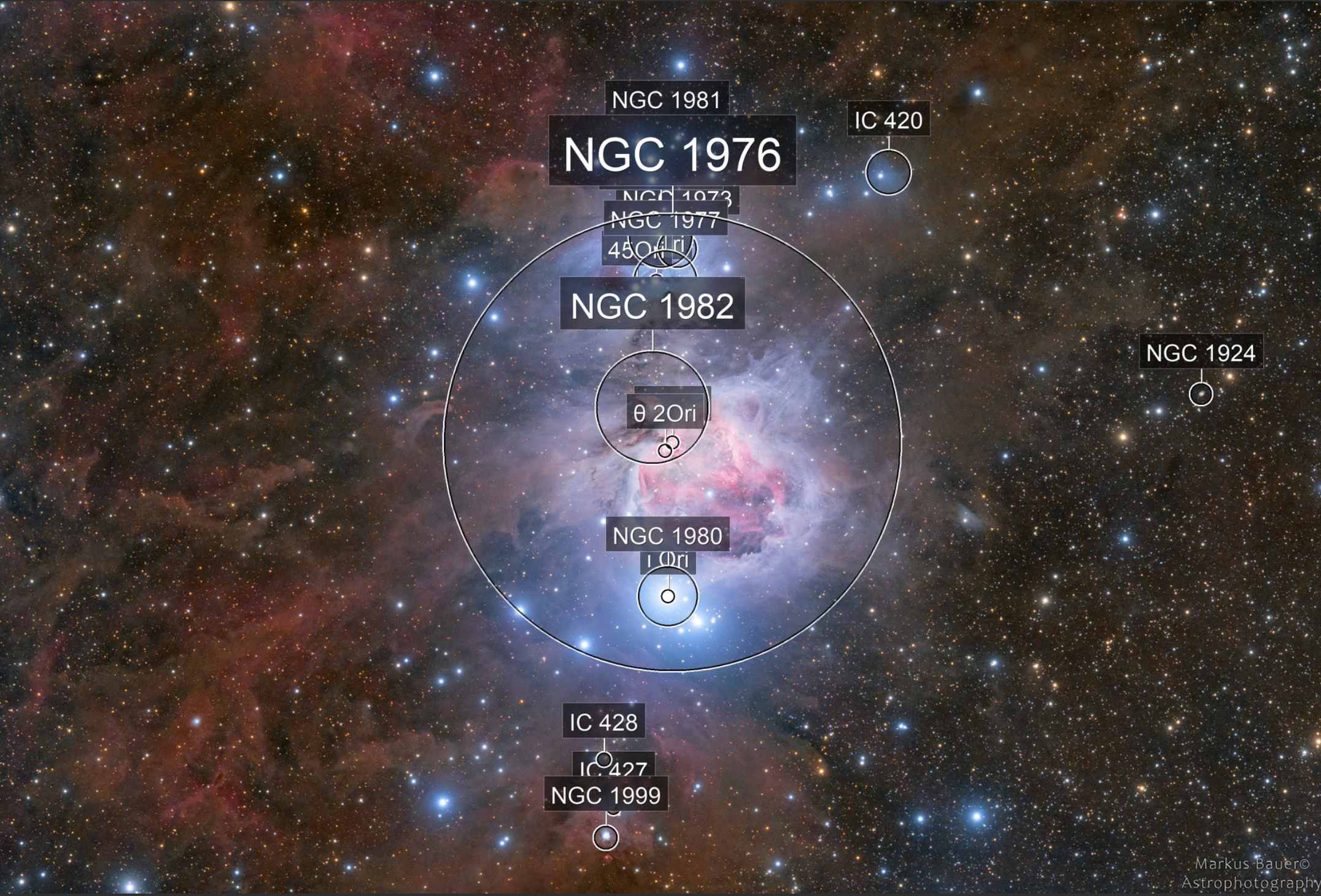
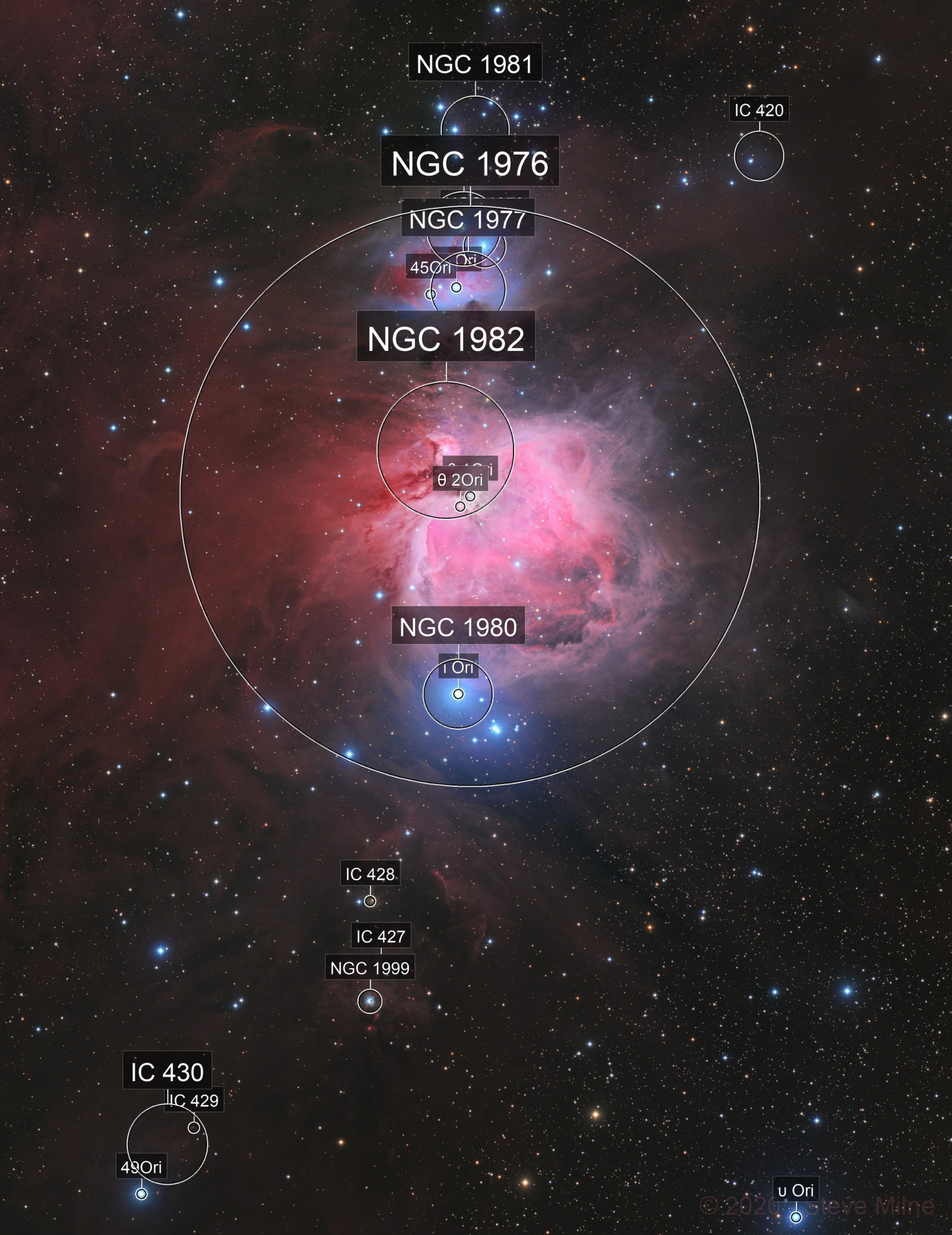
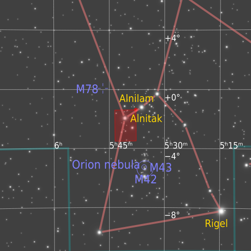
On AstroBin Lite and Premium
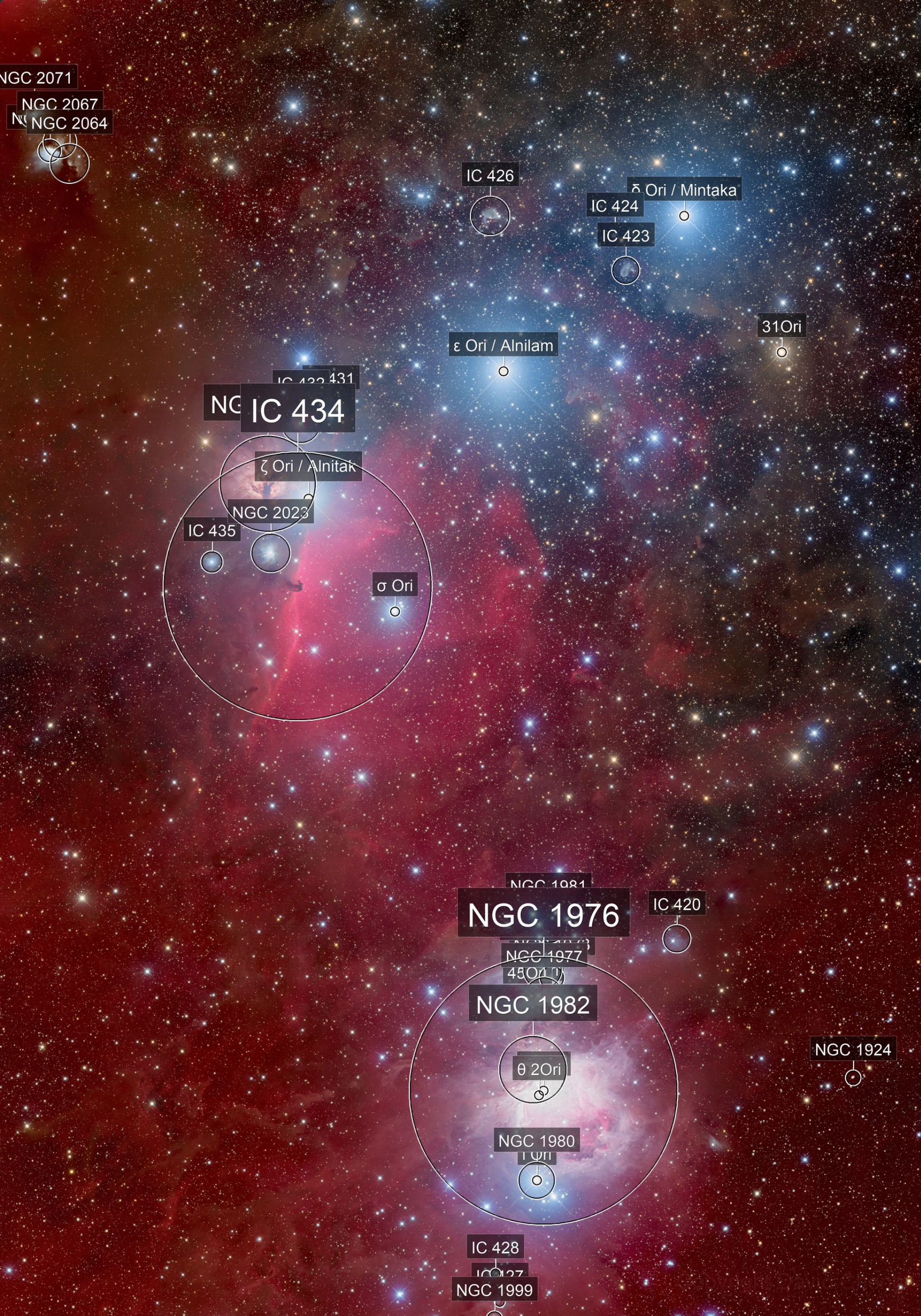
Users of the AstroBin Lite and Premium subscriptions get access to the regular plate-solving experience that has been on AstroBin since the beginning: it uses Astrometry.net as a backend, and accurately solves most deep-sky images. The annotations identify most Messier, NGC, and IC objects, plus named stars. The biggest limitation is that wide-field images are going to be less accurate due to field distortion (plate-solving works by star triangulation and wide fields will suffer from distorted angles).
Annotations are only displayed, as they have since 2010, on the main image page, but not in high resolution.
Some examples of what it looks like for AstroBin Lite and Premium

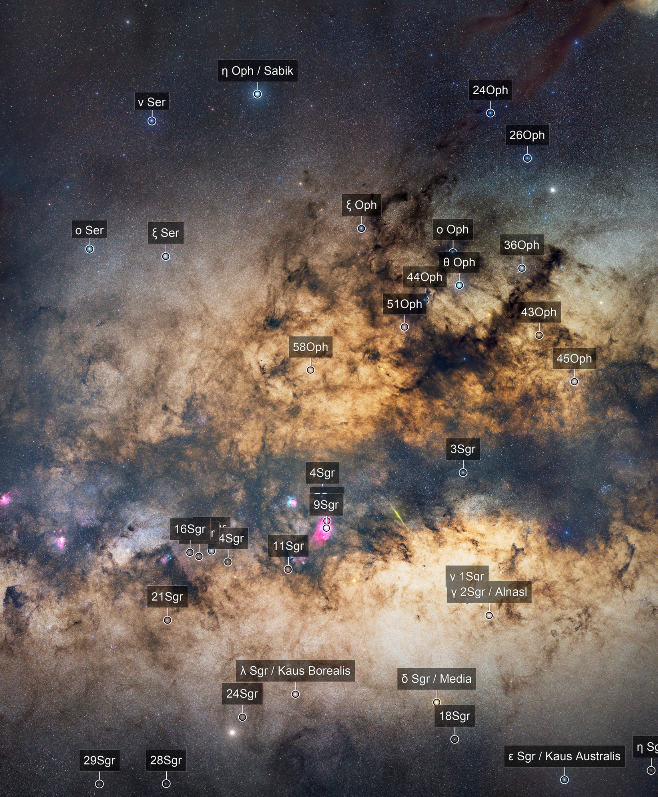
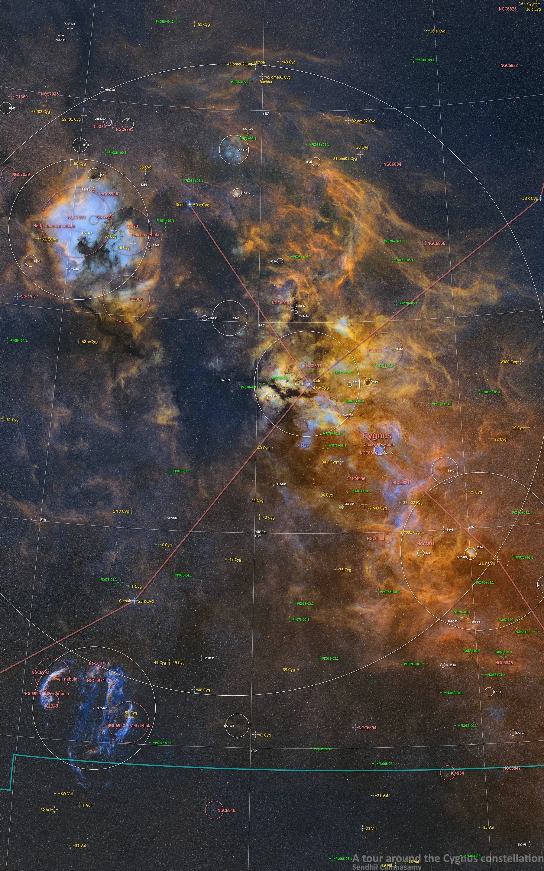
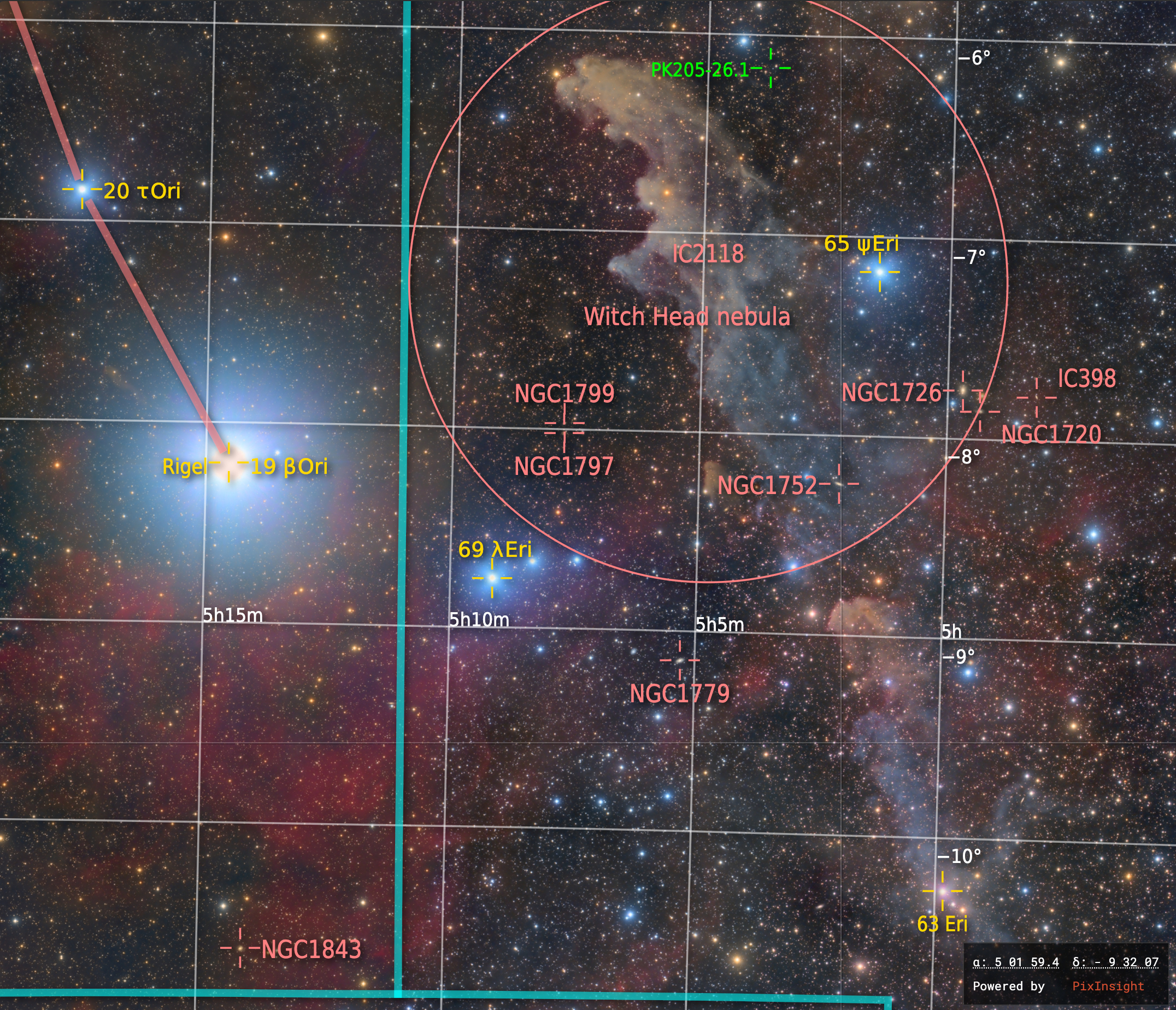
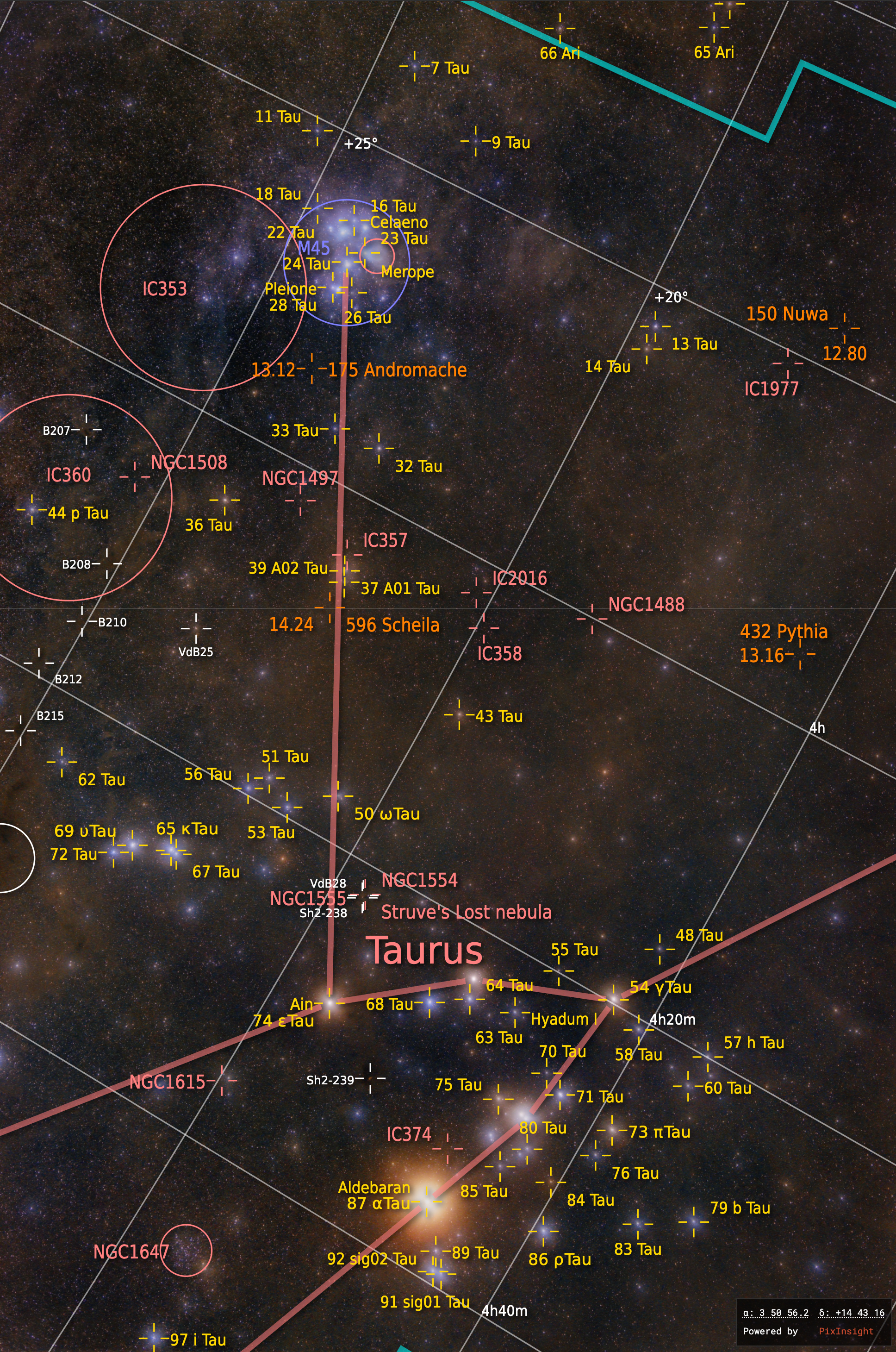
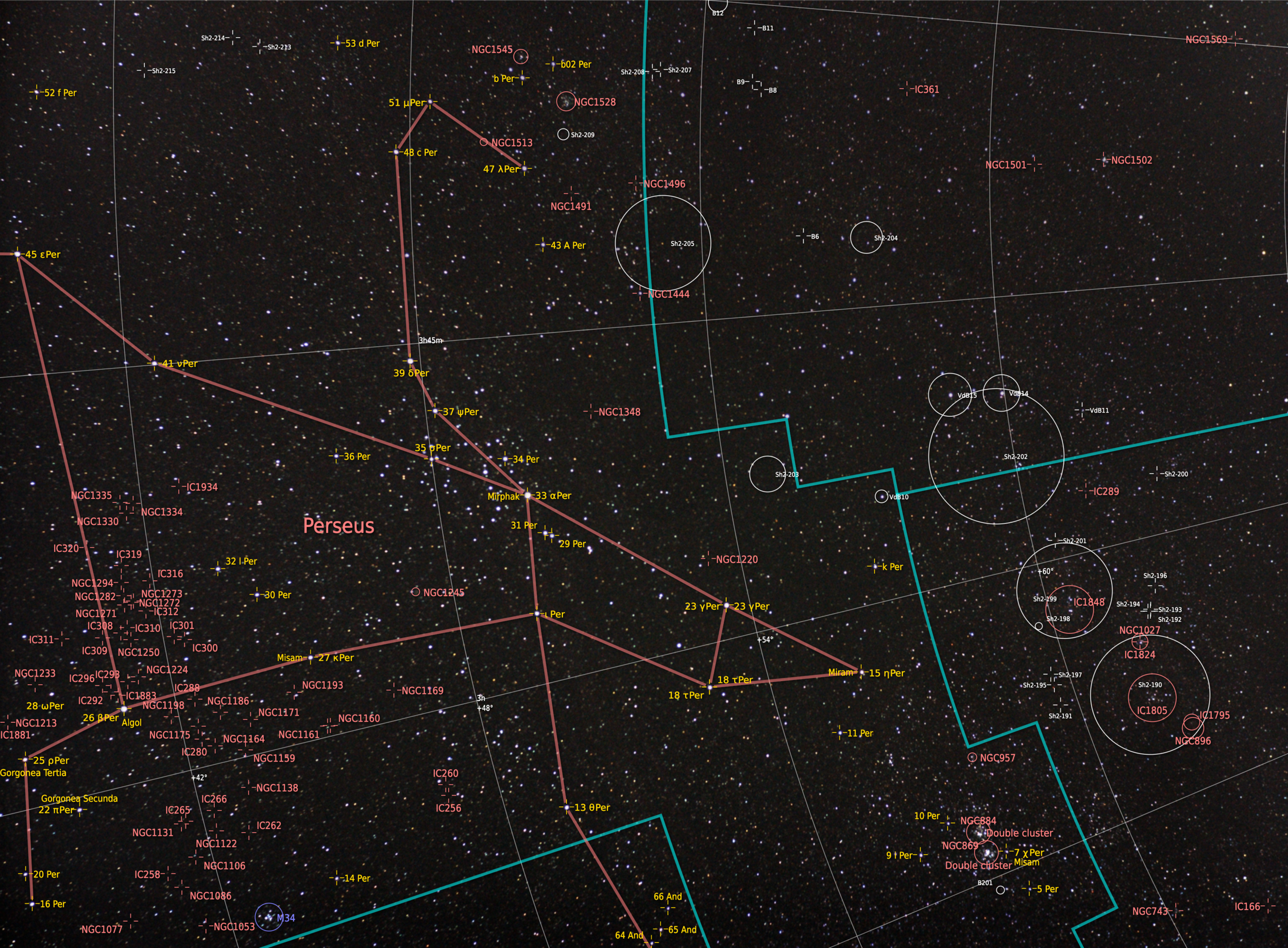
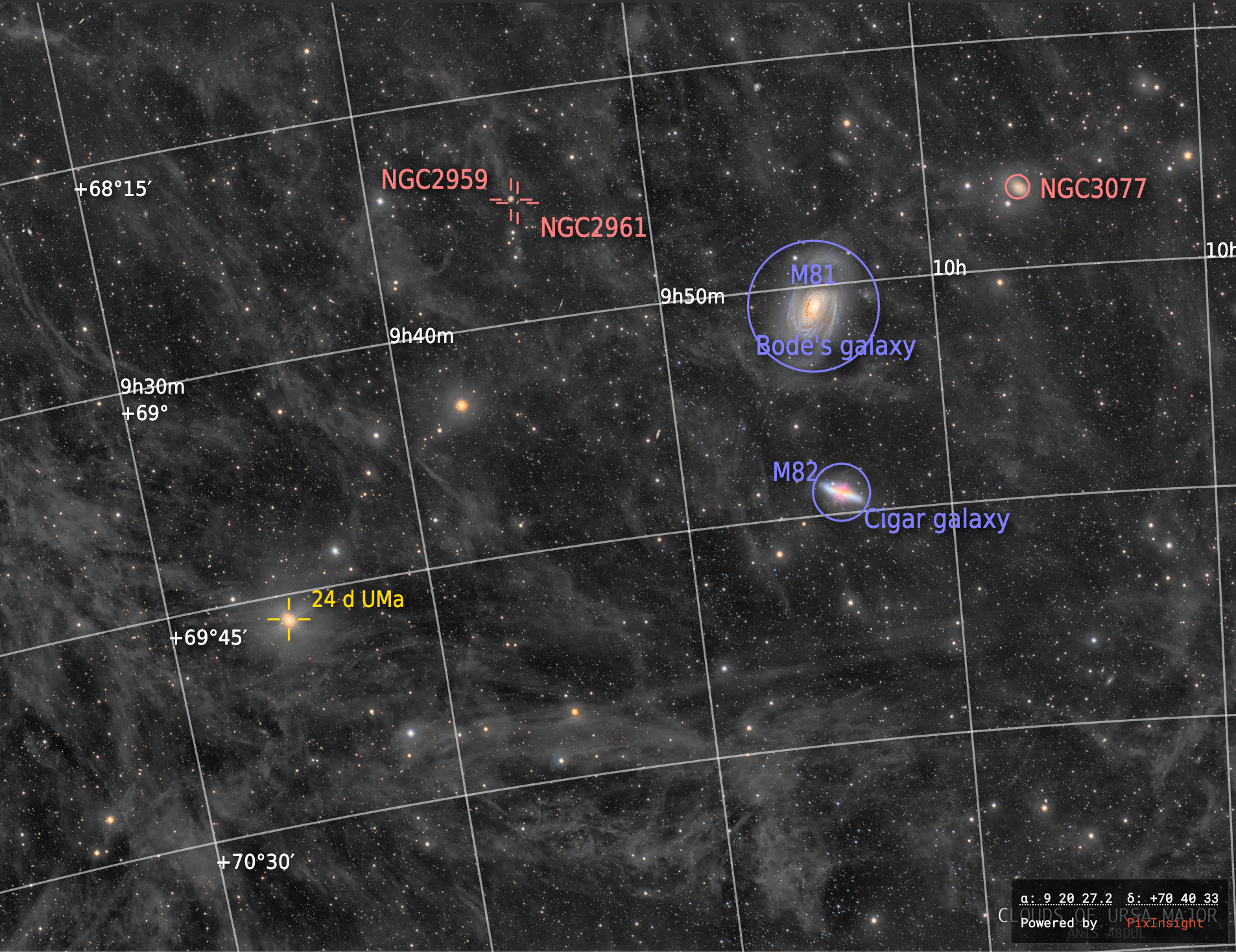
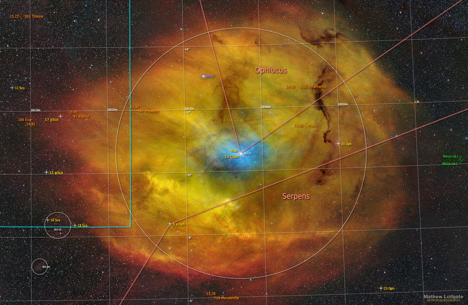
On AstroBin Ultimate
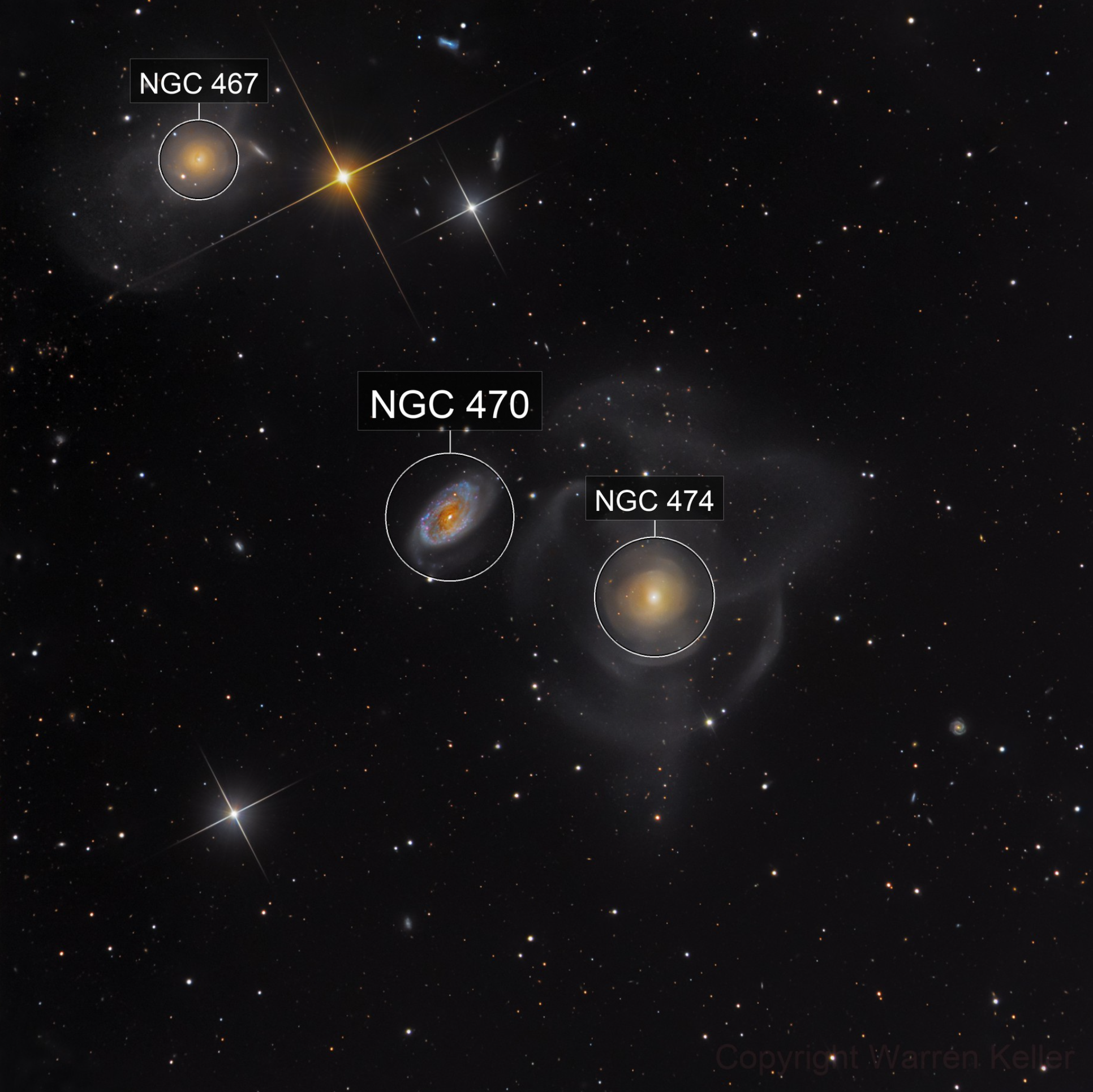
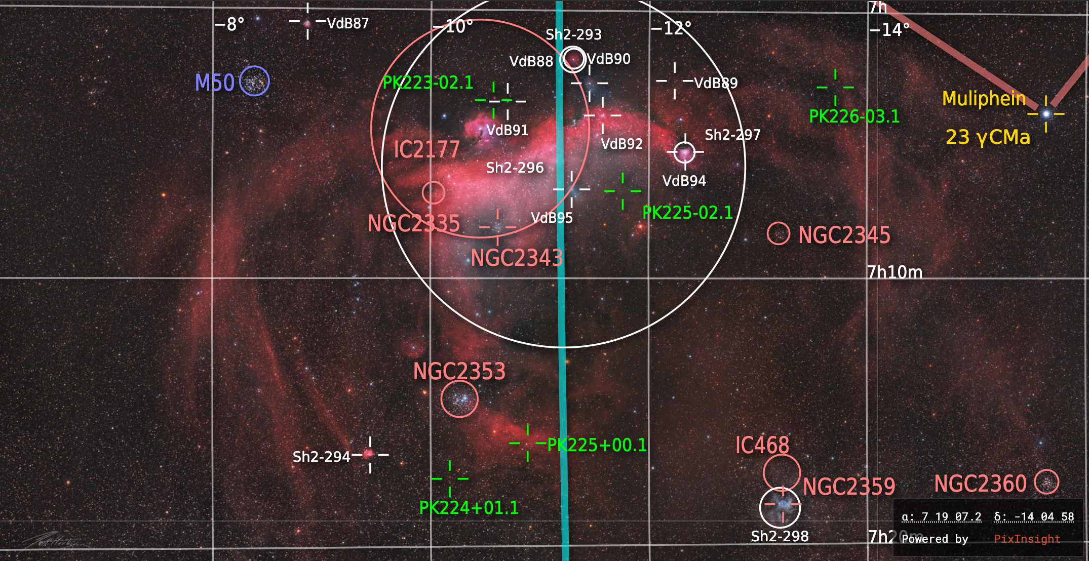
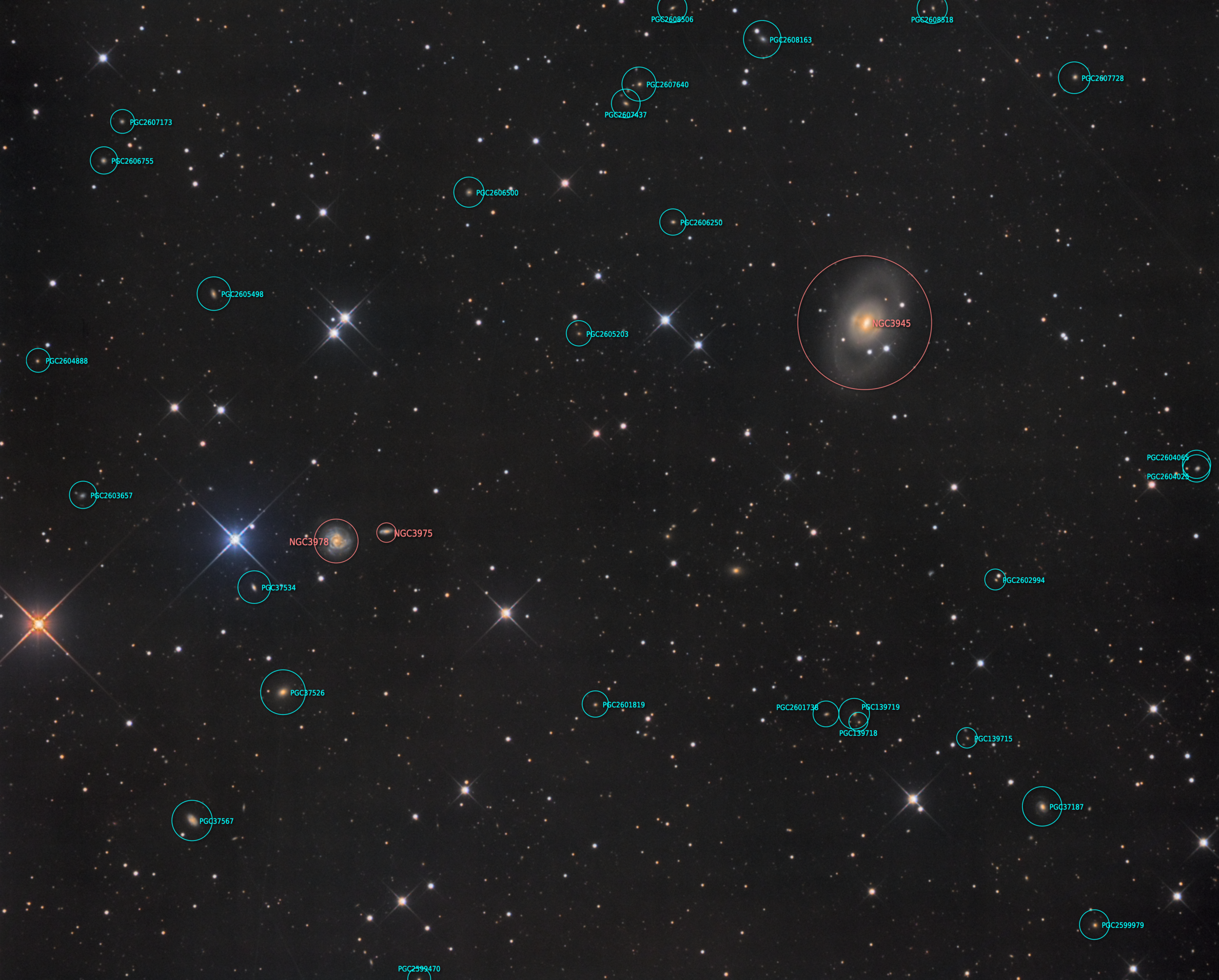
With the advanced plate-solution provided by PixInsight, available in the AstroBin Ultimate subscription plan, images will be solved with a higher level of accuracy that accounts for field distortions (read more here). This means that wide fields will especially enjoy a more accurate plate solution.
The following object categories are available as annotations:
Right ascension and declination grid
Ecliptic
Galactic equator
Constellation borders
Constellation lines
Named stars
Messier
NGC
IC
VdB
Sharpless
Barnard
LDN
LBN
PGC
GCVS (General Catalogue of Variable Stars)
Tycho-2
Quasars
Planets *
Asteroids *
In addition to a larger catalogue of objects and a more accurate plate-solution, the advanced plate-solving available on AstroBin Ultimate also offers a Space Cursor to explore coordinates on your images, and full customization of the annotated objects, so you can turn on or off any of the categories above.
Finally, you can view your annotated image in full size too!
Some examples of what it looks like for AstroBin Ultimate

Celestial coordinates layer

With the advanced plate-solving feature available on AstroBin Ultimate, you can visualize the following coordinates:
Right ascension and declination
Ecliptic longitude and latitude
Galactic longitude and latitude
Sky plot
With the advanced plate-solving feature available on AstroBin Ultimate, images are accompanied by a more detailed sky plot, also known as finding chart, of the imaged area of the sky.
Note*: as most images uploaded on AstroBin are processed stacks of multiple images, fast moving objects like asteroids cannot be recognized as there isn't a single time of observation (an image will probably be acquired over multiple hours or even nights). To find planets and asteroids on your image, you will be able to upload a sample raw data file (in XISF or FITS format and with date and time headers), that will be associated to your image.